WA Tampia Gold Project
The Tampia Hill Project, Western Australia
The Tampia Hill gold deposit (held by Explaurum Ltd when the project work was undertaken), is located near the town of Narembeen in the Wheatbelt of Western Australia, 25 km east of Perth. The deposit has a 2012 JORC-compliant inferred resource of 4.7 Mt ore at 2.0 g/t Au, and contains 310,000 oz of gold. Furthermore, 380,000 ounces of gold, including 1.6 MT ore at 3.4 g/t Au or 4.6 g/t Au containing 170,000 to 237,000 ounces of gold was announced in April 2015.
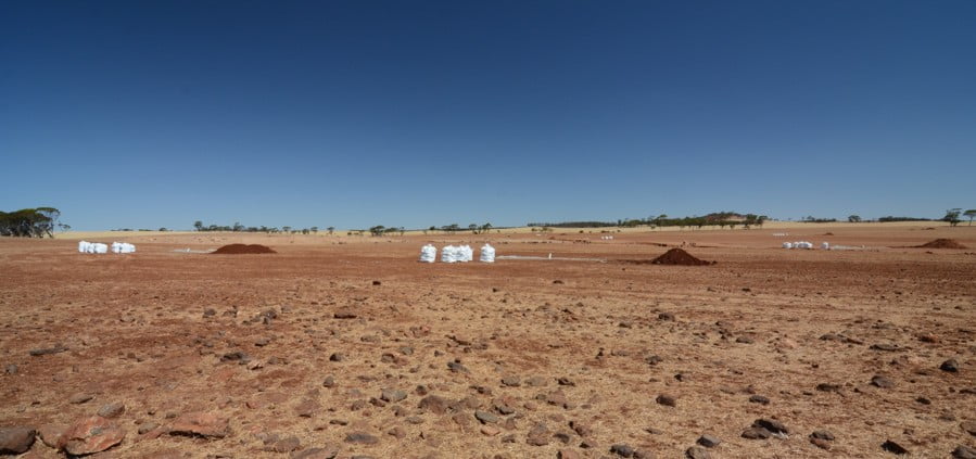
When exploration began, the geology and structural history were poorly understood, mainly due to farming activity and lack of outcrop. The lack of outcrop meant geophysics, RC logging, and downhole interpretations of optical televiewer (OTV) images have been vital for the interpretation of the underlying lithology and structures to date, and has also provided critical information about the general geology and mineralisation of the area.
Using these data, a structural framework was established to guide the creation of 2D and 3D geology and mineral potential maps. The 3D mineral potential map was used to constrain resource estimates and for drill targeting, whilst the 2D mineral potential map was used to establish targets outside of the mine area for further exploration drilling.
Tampia Hill
2D Mineral Potential Mapping and Targeting
Our results confirm that the gravity data not only provides critical geological data, but will also allow for the identification of high priority targets for future exploration using spatial data modelling techniques. The strong correlation between high gravity with low magnetic signatures to known gold mineralisation confirms that gravity can be a robust predictor of gold mineralisation in the Tampia region. It has also highlighted a number of, as yet untested, areas with similar gravity signatures and anomalous gold geochemical signatures to that at the Tampia Hill gold deposit.
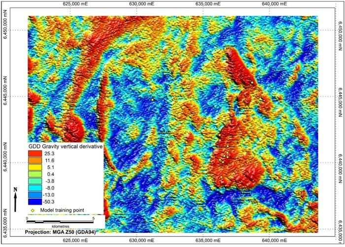
Geophysical Survey
3D Modelling
Logging of drill holes using wireline tools is an emerging methodology in mineral exploration that adds valuable data to exploration drilling. RC drilling is relatively cheap and quick, but it comes with the cost of lower geological resolution and complete loss of structural coherence. Wireline logging can mitigate this, by facilitating structural interpretations based on drill hole imagery. Rock property data can also be measured at resolutions better than the sample spacing, such as OTV imagery, density, magnetic properties, natural gamma radiation, and acoustic properties on cm and even mm scale.
Combined with on-site logging of lithology and data from tools used in the field, wireline logging has enabled the exploration team to take a significant step towards a more complete understanding of the geology at Tampia Hill.
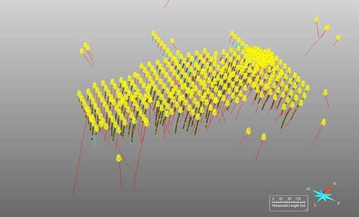
Tampia Hill 3D Drilling visualization
Learn more about this project
Publications: