Ghana Kumasi Basin Orogenic Gold Potential
Kumasi Basin Mineral Potential Mapping, Ghana
In 2014 Kenex completed a mineral potential map for orogenic Au mineralisation over the Kumasi Basin and Asankrangwa Gold Belt in southern Ghana for Asanko Gold. The Kumasi Basin is part of the West African Craton, and is dominated by the Birimian Supergroup metasedimentary and metavolcanic rocks, which were intruded by Proterozoic granites of the Eburnian Plutonic Suite. The basin lies between the highly prospective Ashanti Belt to the southeast, and the Sefwi-Bibiani Belt in the northwest. The orogenic Au mineralisation is hosted in the Birimian Supergroup metasediments and the basin-type granites.
Using the GIS-based weights of evidence and logistic regression spatial data modelling techniques, orogenic Au mineral potential maps were created for the Kumasi Basin. The mineral potential mapping represented a good example of how to undertake this kind of spatial data modelling using sparse data, identified key exploration targeting criteria, and highlighted areas of elevated prospectivity from which targets could be derived.
Targets for orogenic Au exploration were then attributed and ranked based on their relative prospectivity. These targets can then be reviewed to prioritise followup work.
An exploration GIS has been compiled of all relevant geological data over the study area of the Kumasi Basin in southern Ghana. It contains a wide range of files of geological, geophysical, geochemical, topographic, and cadastral data, as well as predictive maps, mineral potential maps, and targets.
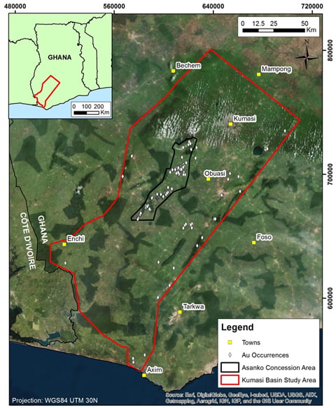
Kumasi Basin study area
Learn more about this project
Publications: