Zambia IOCG Potential
Zambia
Kenex has undertaken mineral potential mapping in Zambia which evaluated the potential for iron-oxide copper gold (IOCG) mineralisation throughout the country and also extending south into Namibia and Botswana. We used the GIS-based fuzzy logic spatial data modelling technique with publicly available geological, geophysical, and geochemical databases to generate new targets for IOCG exploration. These targets are being used to for tenement acquisition and plan exploration programmes in Zambia.
IOCG deposits include many diverse ore systems. They are found on all continents, generally in post-Archean rocks from the Early Proterozoic to the Pliocene, and are located in zones of extensional tectonics along pre-existing rift zones. IOCG mineral systems are usually known to contain significant amounts of igneous activity, high heat flow, and source rocks that are relatively oxidised. The IOCG deposits of western Zambia, northwestern Botswana, and northern Namibia are found in rocks of the Lufilian Arc, a Mesoproterozoic to Neoproterozoic rift basin which closed during the Pan-African Orogeny.

Our mineral potential mapping was based on information from the weights of evidence modelling of the Eastern Fold Belt of the Mt Isa Inlier in Queensland, Australia where the relationships between IOCG deposits and their source, transport pathways, and traps are well established. This enabled us to reduce the subjective element of the fuzzy logic spatial data modelling technique and understanding of the mineral system model in Zambia where there are few known IOCG deposits. From the mineral potential mapping in Mt Isa and literature on IOCG systems in the Lufilian Arc, we created predictive maps for the model which represented all stages of the mineral system model. These maps were combined using the fuzzy logic technique. The result has mapped areas in Zambia, Namibia, and Botswana with the same geological characteristics as IOCG deposits in the Mt Isa region. These target regions therefore have increased potential to host IOCG mineralisation in Zambia.
The fuzzy logic spatial data modelling reduced the exploration search area by 90% and has generated several targets for follow-up data collection and new mineral potential mapping with detailed geological databases.
You can read more about IOCG mineral potential mapping in Africa in the paper presented by Katie at the SGA / SEG conference in Townsville in 2009.
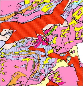
Example of 1:1M geology and mineral occurrence database

LandSAT-TM image of channels 7, 4 , and 2 over Mazabuka
Learn more about this project
Publications: