PNG Offshore Habitat Mapping
Papua New Guinea Habitat Modelling
In 2012, Kenex completed two offshore habitat modelling studies in the New Ireland Province in Papua New Guinea (PNG) for corals and barnacles. Predictive habitat modelling allows for long term management of habitats when increased pressure is placed on them by external human activity such as mining.
This study used the available bathymetry, substrate, and biological data provided by an offshore exploration company, along with modern spatial data modelling to develop predictive habitat models for Keratoisis sp. and V. parensis.The weights of evidence spatial data modelling technique was used to evaluate the strength of the relationship between known coral and barnacle habitats and predictive maps derived from the bathymetry, sustrate, and biological data. Those with the best correlations were integrated to produce habitat potential maps within the study area.
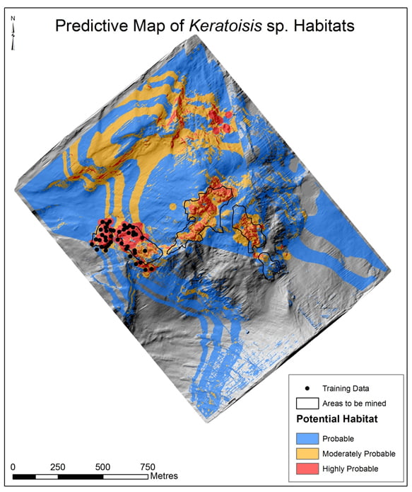
Coral habitat potential map.