PNG Mineral Potential Project
Papua New Guinea
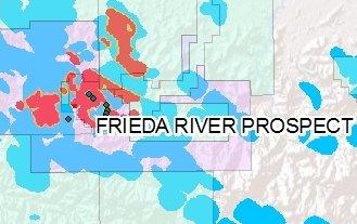
Kenex are offering porphyry Cu-Au, low sulphidation epithermal Au, and skarn mineral potential maps to companies with an interest in mineral exploration and mining in Papua New Guinea (PNG). We have developed a functional exploration GIS that contains relevant spatial data and three mineral potential maps. These mineral potential maps identify the most prospective areas of porphyry Cu-Au, epithermal Au-Ag, and skarn mineral systems in PNG with respect to the current exploration models for those mineral systems.
The GIS has been compiled from available open file geological, geochemical, and geophysical data over PNG. A structural geological review of regional as well as local controls on mineralisation has been completed and the structural model checked against the geology, geophysics, and geochemical results. The geochemical data has been reviewed statistically at a regional scale to derive local anomaly levels for gold, silver, copper, arsenic, molybdenum, antimony, and mercury in rock and stream sediment samples. In summary the compiled GIS has been used to:
- Develop mineral potential maps to identify the most prospective areas in PNG for porphyry Cu-Au, epithermal Au-Ag, and skarn mineralisation.
- Derive anomalous threshold levels for geological, geochemical, and geophysical data.
- Identify missing data that needs to be collected to upgrade the prospectivity of targets.
- QA the database against exploration models being used.
- Review exploration models in relation to current exploration.
- Prioritise a list of those geological variables that are the best predictors of mineralisation.
- Review current exploration techniques in relation to exploration models used in the modelling.
- Review current exploration prioritisation in relation to prospect priorities identified by the modelling.
- Develop recommendations for follow-up field work.
Kenex consider that the mineral potential maps generated for PNG along with the exploration GIS would be a valuable tool in enabling a company to accelerate its exploration, identify opportunities inside and outside your current tenement package for joint venture or acquisition, and to get ahead of competitors. Furthermore, through the integration of prospect scale exploration data the mineral potential maps can be updated to provide exploration focus through prioritisation of targets that fall within an existing tenement portfolio.
The national scale mineral potential maps and GIS data package are available on a multi client basis, please contact us for more information.
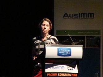
Katie presenting preliminary PNG modelling at the PACRIM 2008 confrerence (Read the paper).