Duke Exploration’s Bundarra Project
Kenex has worked closely with Duke to develop their Bundarra project from the beginning.
Starting with regional targeting to identify the project, Kenex have since worked on data compilations and reviews of historic work, mineral potential mapping, initial field work, exploration targeting and detailed 3D modelling at Mt Flora, regional and tenement scale 2D and 3D mapping, through to drill supervision at Mt Flora, creation of a rock library database and management of the exploration database. See the story to date.
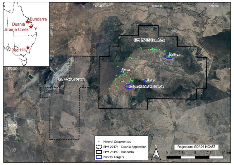
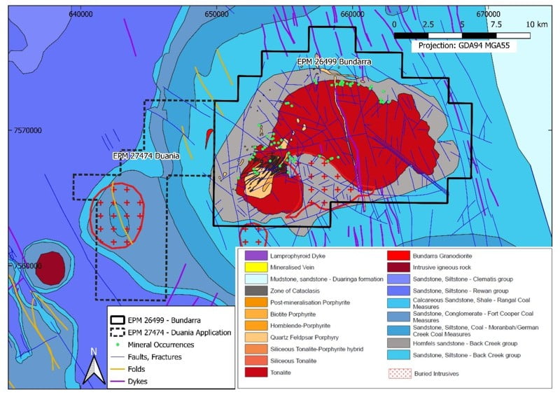
Bundarra is located 130 km SW of Mackay and 50 km east of Moranbah in Central Queensland. There are 47 prospects and small historic mines in the Bundarra tenement, which occur around the margins of the Bundarra Igneous Complex, an Early Cretaceous composite intrusive system that intrudes Lower Permian Back Creek Group carbonaceous shale, sandstone, and marl. Historic copper production commenced in the late 1800s from numerous small prospects, restarted in the early 1900s, and again in the 1970s. Almost all the historical production came from workings on veins and lodes located in fracture zones within 500 m of the intrusive contact.
Regional targeting, mineral potential mapping, and tenement acquisition
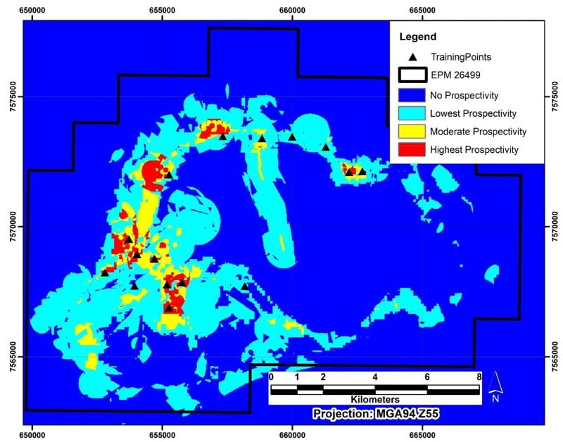
Kenex undertook regional mineral potential mapping in Central Queensland, which highlighted the Bundarra area as the highest ranked target in the region. The area had recently been relinquished, which prompted Kenex to apply for the tenement.
More detailed tenement scale mineral potential mapping used local scale data to refine the targets and allow the most prospective areas of the tenement to be prioritised.
See our story map for more on the mineral potential mapping.
Data compilations, database management and reviews of historic work
Kenex compiled all the historical data from previous work done in the area. The compiled data underwent a QA/QC process and was integrated with existing Kenex databases and an exploration database was created for Duke.
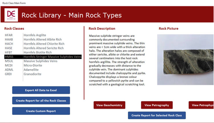
The exploration database contains all historic and recent exploration data, and Kenex provides support to Duke each month with importing and validating new data. A rock library database has also been created, that contains all known information about each rock type present in the tenement – alteration, mineralisation, geochemistry, petrography, petrophysical analyses, photos, and descriptions.
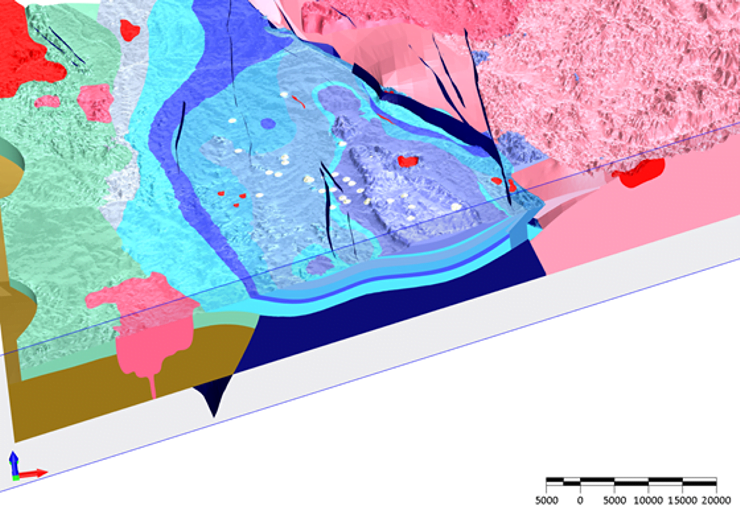
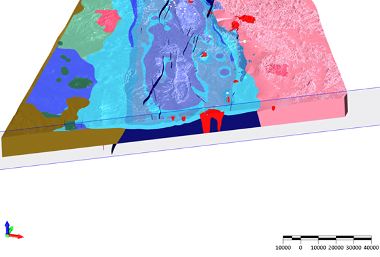
3D mapping
Kenex have made 3D geology maps at various scales for Duke. A regional 3D map has been developed, covering 200 x 300 x 4 km over the northern Bowen Basin. A tenement scale 3D map was made, that is constantly being updated with recently collected data. Detailed 3D maps of the lodes at Mt Flora were made for drill planning and then updated with new drilling data.
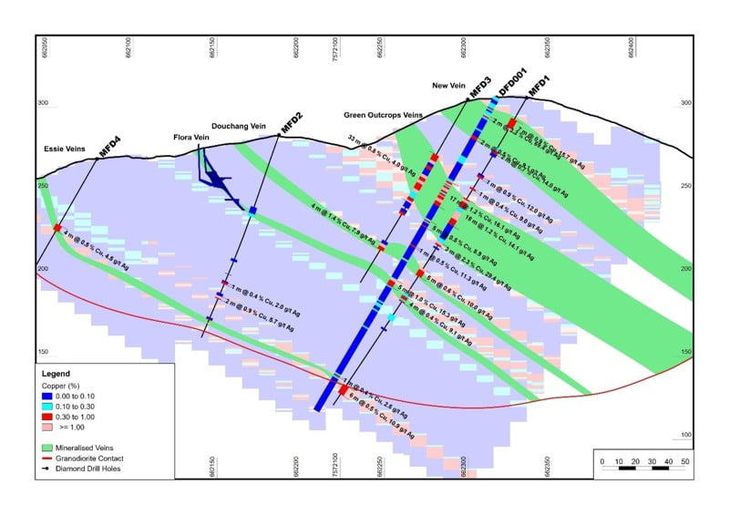
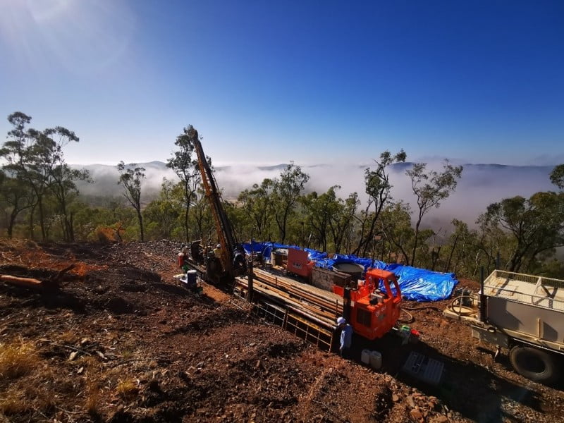
Drill management
Kenex managed Duke’s first drill program at Mt Flora in October 2019. Three diamond drillholes for 550 m were drilled. The drilling confirmed the strong prospectivity at Mt Flora with best results:
- 1.64 m @ 3.18% Cu, 69 ppm Ag, 0.417 ppm Au and 267 ppm Mo.
- 16.65 m @ 1.15% Cu, 16 ppm Ag, 0.03 ppm Au and 120 ppm Mo.
- 4.95 m @ 0.96% Cu, 15 ppm Ag, 0.03 ppm Au, 187 ppm Mo.
- 6.9 m @ 0.7% Cu, 9.6 ppm Ag.
- 4.5 m @ 1.3% Cu, 14 ppm Ag, 0.075 ppm Au, 859 ppm Mo.
- 8.15 m @ 0.92% Cu.

Ongoing work
Duke Exploration listed on the ASX in 2020. Since listing, Duke has drilled more than 100 RC holes at Mt Flora, and at other prospects Quorn and Absolon, and has defined a maiden Inferred Resource at Mt Flora of 16 Mt @ 0.5% Cu, 6.9 g/t Ag (download the pdf here).
Kenex is continuing to support Duke through database support, OTV logging, 2D and 3D geology map updates, and regular monitoring of surrounding tenement holdings.
Kenex is excited to continue our close relationship with Duke and to see the continued exploration success at Bundarra.
Learn more about this project
Publications
Mineral potential mapping of porphyry targets at the Bundarra Cu-Au project, Queensland
Presentations
Presenting mineral potential mapping of porphyry targets at the Bundarra project
Bundarra Project Case Study
Useful links
Duke Exploration Website
Kenex blog