Real-Time GIS Services
Create online sharable applications with real-time data and live updates for efficiently manage emergency responses and large scale, time based campaigns.
Since 2020, Kenex, in partnership with Digital Navigators, has scaled up our offering of custom GIS solutions by creating a series of shared online applications that collect and show real time data and responses for public emergencies, recovery programs, and health and demographic campaigns.
The first applications were made to aid several iwi during the Covid19 emergency to assist their communities during lockdown and during the vaccination campaign. Due to the success of these applications, they are also being utilised to organise and manage more community-focussed programs, such as tracking Census responses and organising flu vaccination programs.
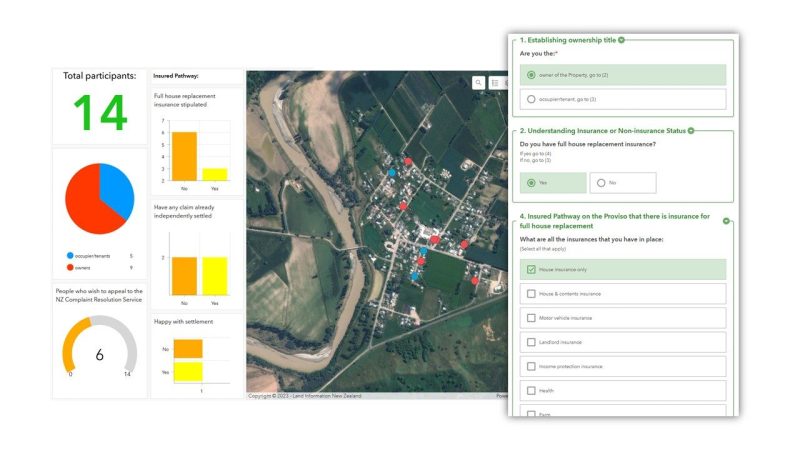
New custom applications, or packages of applications, are now often requested, especially in the case of a large-scale emergencies when community focussed as well as region-wide recovery programs are needed. A recent example of this is Cyclone Gabrielle that has affected many families in the North Island.
Kenex and Digital Navigators continue to implement the online platform, upskilling our employees to keep up with the latest tools and improvements, and assisting our clients with any of their real-time response projects.
Related Projects

Covid 19 Emergency response
During the COVID-19 lockdowns in 2020, Kenex and Digital Navigators were approached by several iwi in the North Island seeking help with organising their response…